WOKU INDEX


Map of Uji — Census Ordination under Chief Ieday (Government Record)
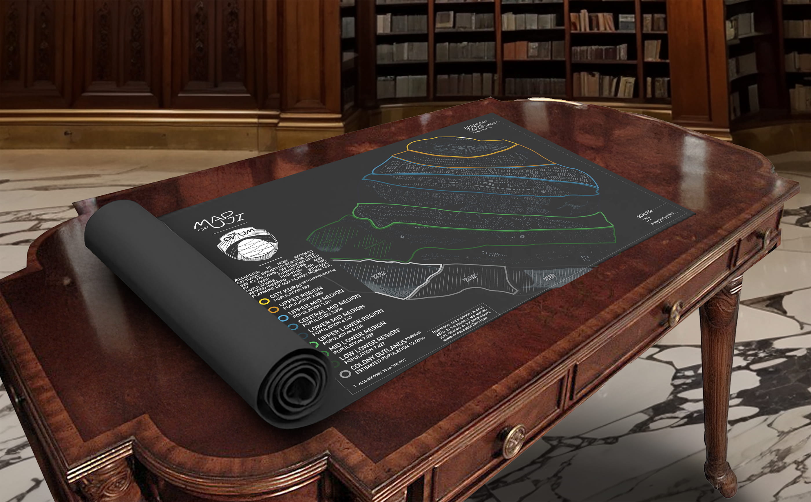
This officially sanctioned map of Uji was produced following a census ordained by the Governmental Ranks under the guided leadership of Chief Ieday, and penned by the Statistics and Mapping Department. Rendered with precision and restraint, the map delineates Uji’s layered regions and population strata. It rests within The City Korai Records Office, where it may be checked out for supervised viewing in the Records Office Library, provided the appropriate paperwork is filed.